equivalente azimut- en kegelprojecties
compensatie
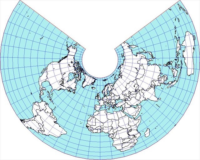
In azimut- en kegelprojecties lopen de meridianen straals uit elkaar. Om een oppervlaktegerouwe kaart te bekomen, moet je deze verwijding compenseren door de afstanden tussen de parallelcirkels te verkleinen.
In de praktijk wordt ook slechts een deel van de globe afgebeeld en antarctica weggelaten.
compensation
In azimuthal and conic projections the meridians widen as radii. To get true area (or equivalent) maps we have to compensate this widening by narrowing the distances between the parallel circles.
In practice only a part of the globe is projected and antarctica is omitted.